Property Record
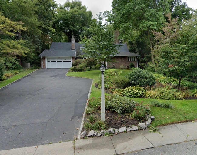
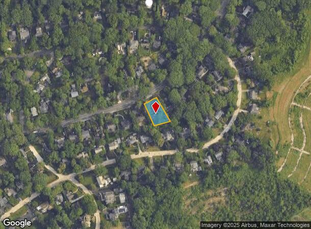
64 Beacon Hill Rd, Port Washington, NY 11050
NEARBY LISTINGS FOR SALE OR LEASE
Property Detail
64 Beacon Hill Rd
Nassau County-Suffolk County, NY
Map Of Part Of Section 4 Beacon Hill Mad
2289-06-031-00-0009-0
TOWN #2 SCH DIST 004
Commercialnec
Nassau
X
New York
36059C0108G
9
2025
0.31 AC
2025
Western Nassau
301000
Long Island (New York)
3,020 SF
DEMOGRAPHICS near 64 Beacon Hill Rd
1 Mile
3 Mile
5 Mile
2024 Total Population
8,525
70,640
173,604
2029 Population
8,455
70,499
174,163
Pop Growth 2024-2029
(0.82%)
(0.20%)
+ 0.32%
Average Age
44
42
43
2024 Total Households
3,054
24,812
60,270
HH Growth 2024-2029
(0.92%)
(0.24%)
+ 0.32%
Median Household Inc
$185,048
$150,046
$149,633
Avg Household Size
2.70
2.80
2.80
2024 Avg HH Vehicles
2.00
2.00
2.00
Median Home Value
$1,029,510
$1,015,377
$1,007,534
Median Year Built
1952
1955
1957
Nearby Places
- Restaurants
- Banks
- Shops
- Fitness
- Groceries
PUBLIC TRANSPORTATION
COMMUTER RAIL
Port Washington Station (Port Washington Branch - Long Island Rail Road)
DRIVE
WALK
Distance
Port Washington Station (Port Washington Branch - Long Island Rail Road)
2 min
18 min
0.9 mi
Plandome Station (Port Washington Branch - Long Island Rail Road)
DRIVE
WALK
Distance
Plandome Station (Port Washington Branch - Long Island Rail Road)
7 min
2.9 mi
AIRPORT
LaGuardia
DRIVE
WALK
Distance
LaGuardia
30 min
18.3 mi
John F Kennedy International
DRIVE
WALK
Distance
John F Kennedy International
33 min
21.1 mi
Westchester County
DRIVE
WALK
Distance
Westchester County
60 min
37.2 mi
Freight Ports
NY - Red Hook Container Terminal
DRIVE
WALK
Distance
NY - Red Hook Container Terminal
41 min
26.4 mi
Nearby Properties
Address
Land Use
TOTAL SIZE
Lot Size
Zoning
Address
Land Use
TOTAL SIZE
Lot Size
Zoning
375,331 SF
14.83 AC
Address
Land Use
TOTAL SIZE
Lot Size
Zoning
251,828 SF
31.03 AC
Address
Land Use
TOTAL SIZE
Lot Size
Zoning
26,200 SF
186 AC
Address
Land Use
TOTAL SIZE
Lot Size
Zoning
196,507 SF
133.37 AC
Address
Land Use
TOTAL SIZE
Lot Size
Zoning
401,583 SF
17.93 AC
Address
Land Use
TOTAL SIZE
Lot Size
Zoning
50,252 SF
143.04 AC
Address
Land Use
TOTAL SIZE
Lot Size
Zoning
164,742 SF
3.54 AC
Address
Land Use
TOTAL SIZE
Lot Size
Zoning
387,645 SF
7.21 AC
Address
Land Use
TOTAL SIZE
Lot Size
Zoning
171,770 SF
5.95 AC
Address
Land Use
TOTAL SIZE
Lot Size
Zoning
179,365 SF
6.05 AC
Address
Land Use
TOTAL SIZE
Lot Size
Zoning
237,994 SF
3.98 AC
Address
Land Use
TOTAL SIZE
Lot Size
Zoning
45,898 SF
85.13 AC
Address
Land Use
TOTAL SIZE
Lot Size
Zoning
98,439 SF
8.94 AC
Address
Land Use
TOTAL SIZE
Lot Size
Zoning
155,256 SF
25 AC
Address
Land Use
TOTAL SIZE
Lot Size
Zoning
56,663 SF
388.75 AC
Address
Land Use
TOTAL SIZE
Lot Size
Zoning
102,595 SF
21.45 AC
Address
Land Use
TOTAL SIZE
Lot Size
Zoning
161,595 SF
29.91 AC
Address
Land Use
TOTAL SIZE
Lot Size
Zoning
140,916 SF
3.14 AC
Address
Land Use
TOTAL SIZE
Lot Size
Zoning
114,248 SF
80.99 AC
Address
Land Use
TOTAL SIZE
Lot Size
Zoning
130,665 SF
9.91 AC
Address
Land Use
TOTAL SIZE
Lot Size
Zoning
52,275 SF
27.63 AC
Address
Land Use
TOTAL SIZE
Lot Size
Zoning
95,147 SF
207.90 AC
Address
Land Use
TOTAL SIZE
Lot Size
Zoning
123,240 SF
13.67 AC
Address
Land Use
TOTAL SIZE
Lot Size
Zoning
1,500 SF
24.12 AC
Address
Land Use
TOTAL SIZE
Lot Size
Zoning
19,259 SF
12.22 AC
Address
Land Use
TOTAL SIZE
Lot Size
Zoning
2,860 SF
20.37 AC
Address
Land Use
TOTAL SIZE
Lot Size
Zoning
70,230 SF
15.20 AC
Address
Land Use
TOTAL SIZE
Lot Size
Zoning
81,403 SF
3.09 AC
Address
Land Use
TOTAL SIZE
Lot Size
Zoning
6,278 SF
25.30 AC
Address
Land Use
TOTAL SIZE
Lot Size
Zoning
123,337 SF
11 AC
The World's #1 Commercial Real Estate Marketplace
Connect with us
© 2025 CoStar Group
The information above has been obtained from sources believed reliable. While we do not doubt its accuracy we have not verified it and make no guarantee, warranty or representation about it. It is your responsibility to independently confirm its accuracy and completeness. Any projections, opinions, assumptions, or estimates used are for example only and do not represent the current or future performance of the property. The value of this transaction to you depends on tax and other factors which should be evaluated by your tax, financial, and legal advisors. You and your advisors should conduct a careful, independent investigation of the property to determine to your satisfaction the suitability of the property for your needs.